1. Overview
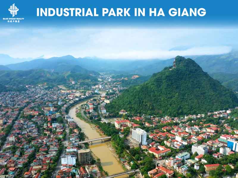
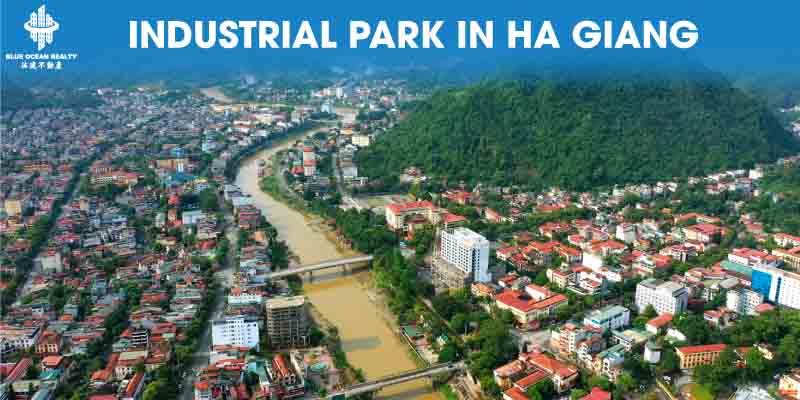
Industrial Park Development In Ha Giang Province | Ha Giang, located in Vietnam’s Northeast, covers an area of 7,884.37 km² and is renowned for its breathtaking landscapes. As the northernmost province of the country, it captivates visitors with vast rice terraces, rapeseed, peach, plum, and buckwheat blooms, along with rich highland cultures.
2. Geography & Topography
Situated in the high mountains of northern Vietnam, Ha Giang features rugged terrain, with average altitudes of 800–1,200 m above sea level. It is interlaced with fast-flowing rivers and streams, characterized by variable depths and steep rapids.
3. Mineral Resources & Hydropower
Ha Giang is rich in mineral reserves, with 215 active deposits and 28 types of minerals including iron (21 sites), lead-zinc (16), manganese (27), antimony, gold, tin, tungsten, and others—making deep-mineral processing a strategic development path.
Hydropower is also a key asset: 46 hydropower projects have been identified, with a total installed capacity of 772.8 MW. As of now, 22 plants are operational with a combined capacity of 354.3 MW.
4. Border Gates & Trade
Ha Giang hosts the international Thanh Thuy – Thien Bao border gate on National Highway 2, 22 km north of Ha Giang City. Additionally, there are three minor border crossings (Sam Pun – Dien Bong, Pho Bang – Dong Can, Xin Man – Do Long), along with 11 informal border routes. Annual import-export trade through these gates exceeds USD 300 million. Infrastructure for customs and border markets is being developed to facilitate cross-border commerce.
On this basis, with strategic policies, Ha Giang is expected to grow further and fully embrace its role as Vietnam’s northern frontier.
5. Geographic Borders
- North: Guangxi Zhuang Autonomous Region, China (Wenshan prefecture — Bách Sắc and surrounding counties)
- East: Cao Bang Province (Vietnam)
- West: Yen Bai and Lao Cai Provinces (Vietnam)
- South: Tuyen Quang Province (Vietnam)
6. Administrative Divisions
Ha Giang comprises 11 district-level units:
1 City: Ha Giang
10 Districts: Bac Me, Bac Quang, Dong Van, Hoang Su Phi, Meo Vac, Quan Ba, Quang Binh, Vi Xuyen, Xin Man, Yen Minh
These include a total of 5 wards, 13 townlets, and 175 communes.
7. Demographics
As of April 1, 2019, the population was 854,679—one of the most populous among mountainous provinces. Ethnic makeup: H’Mong (32.9%), Tay (23.2%), Dao (14.9%), Kinh (12.8%), Nung (9.7%), plus other minority groups.
Religious affiliations include 40,393 adherents: Protestants (35,960), Catholics (4,110), Buddhists (290), small numbers of Muslims, Cao Dai, Hoa Hao, and Minh Ly followers.
8. Health
The province maintains 19 regional polyclinics and 177 local health stations with over 500 hospital beds. Every health facility has at least one resident doctor (143 full-time, 54 rotational). Midwives and pediatric nurses are present in all remaining communal stations. The current healthcare ratio stands at 32.6 hospital beds per 10,000 people.
9. Education
Ha Giang has 820 educational institutions, including 13 ethnic boarding schools and 180 semi-boarding schools. With over 18,000 education staff, the province still requires approximately 1,700 additional teachers—primarily for early childhood education. Many classrooms and teaching resources remain unavailable or in poor condition. Strengthening and rebuilding schools is now a top strategic priority.
10. Tourism
Ha Giang offers uniquely attractive destinations year-round:
- Vuong Clan Mansion (Sa Phin): National heritage site
- Dong Van Karst Plateau Geological Park: UNESCO-recognized (Dec 2010)
- Lung Cu Flag Tower: Northernmost point of Vietnam
- Ma Pi Leng Pass: One of Vietnam’s four most iconic mountain passes
- Yen Minh Pine Forest: Often likened to Vietnam’s mini-Da Lat
- Sung La Valley: Known as the “Flower Valley of the Karst Plateau”
- Quan Ba Heaven’s Gate: Gateway to Dong Van plateau at 1,500 m above sea level
- These sites, combined with ethnic cultural experiences, make Ha Giang a tourism gem.
11. Infrastructure & Transport
Building transportation infrastructure is a core breakthrough of the provincial plan for 2020–2025 (vision to 2045). From 2015 to 2020, more than VND 8,600 billion was invested to upgrade:
- 650 km of national and provincial roads
- 320 km of district roads
- 86 km of urban roads
- 8.5 km of internal roads within industrial and tourism zones
- 2,662 bridges and drainage structures
- 1,790 km of rural roads
Today, 100% of administrative communes have access to paved roads. However, Ha Giang remains the only Northeast province without a high speed expressway or airport.
The 2021–2025 transport strategy includes:
Upgrading 170 km of provincial roads to grade IV standards
Enhancing major district roads
Expanding routes to border crossings
Building new bridges over Lo and Gam rivers
Developing inland waterway transport and tourist jetties
Achieving rural road completion for 100% of border communes
12. Economic Performance in 2021
Despite COVID-19 challenges, Ha Giang recorded:
Economic growth: ~5.06% (2020: 2.11%)
Agricultural output: VND 7,975.4 billion
Industrial output: VND 4,221.3 billion
Total provincial investment: VND 11,701.5 billion
Retail & service turnover: VND 11,904.6 billion
State budget revenue: VND 2,700 billion (144.6% of central plan)
New enterprises: 216; cooperatives: 52
Employment creation: 17,428 jobs
Poverty rate reduced by ~3.75%
Strong COVID-19 response and social housing initiatives were implemented successfully
13. 2021–2025 Strategic Objectives
GRDP growth: ~8% annually
Per capita GRDP: VND 55 million
State revenue: VND 4,000 billion
Poverty reduction: 4% per year
Skilled workforce: ≥ 60% training rate
Targets for 2022: 7.5% growth, VND 33 million per capita GRDP, VND 2,800 billion state revenue, 3% poverty reduction, 56.2% skilled workforce.
2023 aims: 8.2% growth, VND 40 million per capita GRDP, VND 3,130 billion state revenue, 57.6% skilled workforce, 4.4% poverty drop.
14. Industrial Park Development In Ha Giang Province
Ha Giang’s industrial sector has shown steady, strategic growth, with strong private investment in branded products: tea, agricultural processing, and tourism-related goods. The province prioritizes mining, processing, and hydropower industries, with encouraging results so far.
Future industrial directions:
- Develop Ha Giang as a multi-sector economic zone with functional areas—free-trade zone, border gate zone, industrial parks and clusters, tourism, residential and service hubs—with integrated infrastructure.
- Binh Vang Industrial Park (Vi Xuyen): 254.77 ha in total; Phase I (142.94 ha) is in development; Phase II spans 115.905 ha.
- New Viet Quang Industrial Park: 200 ha, targeting agro-forestry-aquatic processing and provincial/regional supporting services (training, technology, logistics, transport).
- Industrial zone in Thanh Thuy border economic zone: 180 ha, to attract export-processing, light manufacturing, and supporting industries—excluding heavy-polluting sectors.
Industrial cluster development:
Under Decision 3233/QD-UBND (2016), Ha Giang planned 5 industrial clusters (Nam Quang, Tung Ba, Minh Son I & II, Tan Bac). From 2021 to 2030, 19 clusters are planned; and 24 additional clusters projected for 2031–2050.
Learn more about us:
—
Your trusted partner in Vietnam Real Estate, Industrial Parks, and Invest Vietnam.
Stay Connected:
- Fanpage: blueoceanrealtyvn
- Youtube: BlueOceanRealty , @batdongsanbor , @blueoceanrealtyvietnam
- Instagram: blueoceanrealtyvn
- Tiktok: @bortintuc
Hotline/ Zalo: +84888089696
—